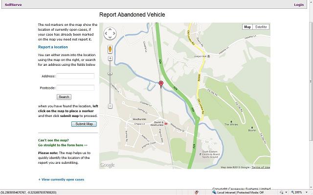
Mapping
There are times when it is easier and more accurate to identify a location by pointing to it on a map. Our Mapping application utilises the flexibility of Google Maps to zoom in to and mark the location of an event such as an abandoned car, dead animal or graffiti.
Mapping can be used with our CRM and our Web Self Service applications. In CRM Customer Services staff can utilise the map pointing out local landmarks to ensure the respondent provides the correct location of the event. In Web Self Service the user can zoom in and use Google Streetview to identify the location. Location co-ordinates are automatically added to the additional information captured on the electronic form (EForm).